Most people need a map to show you where their hometown is. Not in Michigan. Ask someone from the state where they live, and they may simply hold up a hand and point to a spot on it.
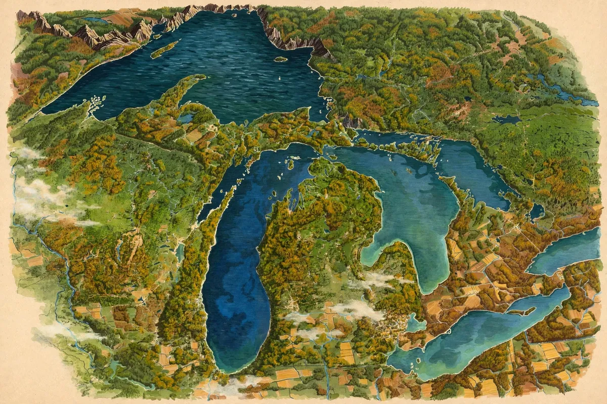
Here's the short answer. Michigan's Lower Peninsula is shaped like a mitten, and many residents use their own hand to show where they're from. The thumb of the mitten is a real region, called the Thumb, which sticks out into Lake Huron.
A State in Two Pieces
Michigan is actually made of two big peninsulas. The mitten is the Lower Peninsula, stretching north from Ohio and Indiana. Above it sits the heavily forested Upper Peninsula, known to locals as the U.P., which juts east from northern Wisconsin.
The two halves are separated by the Straits of Mackinac, where Lake Michigan meets Lake Huron. Since 1957, they've been linked by the 5-mile-long Mackinac Bridge, nicknamed the Mighty Mac. It's the longest suspension bridge between anchorages in the Western Hemisphere.
The mitten itself is big. The Lower Peninsula is about 277 miles from north to south and 195 miles from east to west, and it holds nearly two-thirds of the state's land.
The Thumb and the Little Finger
The Thumb is what really sells the mitten shape. It pokes out into Lake Huron, forming Saginaw Bay between the thumb and the rest of the hand. The Thumb and the nearby Saginaw Valley are known for fertile farmland that grows corn, sugar beets, navy beans, and soybeans.
On the other side of the mitten, the Leelanau Peninsula juts into Lake Michigan. It's sometimes called Michigan's little finger.
The Upper Peninsula has a famous point of its own. The Keweenaw Peninsula reaches northeast into Lake Superior and forms much of Michigan's Copper Country. Long before any of these names existed, the Great Lakes region was home to Indigenous peoples such as the Ojibwe, Odawa, Potawatomi, and Wendat.
Surrounded by Water
Michigan's shape comes from the water around it. The state borders four of the five Great Lakes, plus Lake St. Clair. That gives it the longest freshwater coastline of any U.S. state, at 3,288 miles.
Water covers about 42 percent of Michigan, the highest share of any state. Only Alaska has more total square miles of water. On top of the Great Lakes, there are nearly 65,000 inland lakes and ponds. In fact, no point in Michigan is more than six miles from a natural water source, or more than 85 miles from a Great Lakes shoreline.
Even the state's name may be about water. Some say it comes from the Ojibwe word mishigami, meaning large water or large lake, though there are other theories too.
How Michigan Got Its Upper Half
Michigan almost looked different. Before statehood, it got into a boundary dispute with Ohio known as the Toledo War. Congress gave the disputed Toledo Strip to Ohio. As a concession, Michigan received the western part of the Upper Peninsula, and it joined the Union on January 26, 1837.
That consolation prize turned out to be valuable, rich in lumber, iron, and copper. Michigan led the nation in lumber production from the 1850s to the 1880s. So the next time you see a Michigander hold up a hand to point out their hometown, you'll know the whole story behind the most useful map in America.