Most of us picture a river as a single line on a map: it starts in one place and ends in another. The Mississippi starts at Lake Itasca in northern Minnesota and flows about 2,340 miles south. But when it reaches Louisiana, the story gets more complicated.
Here's the short answer. The Mississippi reaches the Gulf of Mexico by two main routes. Most of its water flows down the main channel past Baton Rouge and New Orleans. But at a spot called Old River, floodgates send about 30 percent of the combined flow of the Mississippi and Red rivers down the Atchafalaya River, a shorter path to the Gulf. Without those gates, the river might abandon its current course altogether.
A River That Likes to Wander
Rivers like the Mississippi don't stay put forever. As the river piles up sand and silt near its mouth, its route to the sea grows longer. Before major levees were built starting in the 1930s, the Mississippi jumped to a shorter route to the Gulf roughly every 1,000 to 1,500 years.
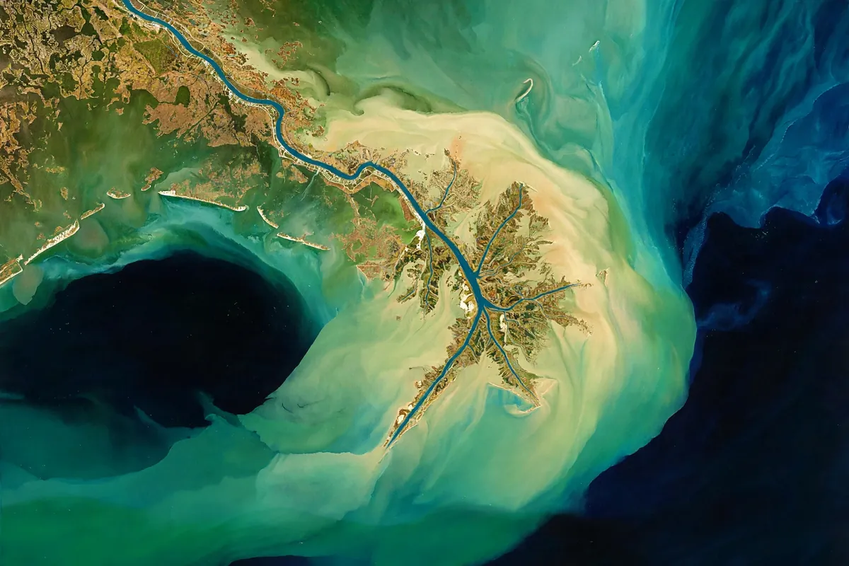
Those shifts built much of Louisiana. The river's old delta lobes helped create more than four million acres of coastal wetlands. The modern Mississippi River Delta formed over about the last 4,500 years.
How the Shortcut Was Born
Starting in the 15th century, a big loop in the Mississippi called Turnbull's Bend grew so far west that it ran into the Red River. The lower part of the Red River became a branch of the Mississippi, now called the Atchafalaya.
In 1831, river engineer Henry Shreve dug a canal across the neck of the loop to save steamboats hours of travel. Then, between 1839 and 1840, locals cleared a huge natural logjam on the Atchafalaya called the Great Raft. With that blockage gone, more and more of the Mississippi's water began heading down the Atchafalaya. Between 1850 and 1950, its share grew from under 10 percent to about 30 percent.
The Gates That Hold Back a River
By 1953, the U.S. Army Corps of Engineers concluded that the Mississippi could switch its main channel to the Atchafalaya by 1990 if nothing was done. That shorter, steeper route was simply too tempting for the river.
So the Corps built the Old River Control Structure, completed in 1963. Its floodgates keep the split at roughly 70 percent down the Mississippi and 30 percent down the Atchafalaya. The great flood of 1973 nearly caused the structure to fail, and a backup structure was added in 1986 to share the load.
The stakes are enormous. If the river ever broke through, it would build a new delta south of Morgan City and send far less water past Baton Rouge and New Orleans, with serious harm to both port cities. One weather expert warned that a failure “would be a serious blow to the U.S. economy.”
And the Other End?
Even the river's starting point has a fun story. Lake Itasca's name was created from parts of two Latin words, veritas for truth and caput for head, to mean the “true head” of the Mississippi. The lake itself, though, is fed by several smaller streams.
So the mighty Mississippi isn't quite as simple as a line on a map. It's a restless river with two paths to the sea, held in place by people determined to keep it from wandering.